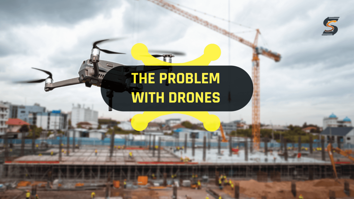

Drone GPR has been hailed as the "next-gen" solution for underground utility mapping and locating. The promises are alluring: the ability to rapidly survey vast areas without any ground contact. However, beneath the sheen of innovation lie significant drawbacks and potential pitfalls that demand our attention.
[There's a few people on LinkedIn that I follow closer than others. Jan Francke is one of those people and this article was inspired by a post he shared a few months ago.]
“Physics is physics. Just as no single GPR antenna radiates 40 MHz – 3 GHz efficiently, drone GPR for utility mapping is fraught with risks: massive loss of penetration, massive loss of resolution, nearly impossible to determine depth of target, and the ease of misinterpretation.” As Jan goes on to say it’s easy to get sucked in. New technology often overpromises, in a fake it, til you make it manner and people want things to be true and “don’t believe their lying eyes”
While newcomers to the GPR field may initially believe that drone GPR is a silver bullet, the reality often reveals a different story, as they embark on their initial surveys and quickly realize the limitations of this approach. There are lots of startups that are using drones like Exodigo and others and they may have alternate use cases or complimentary technology uses but it’s hard to imagine how they could replace conventional locating methods.
Jan’s cites a recent paper by Adam Booth and Tiffany Koylass from the University of Leeds which sheds light on the limitations of drone based GPR. The paper underscores the importance of understanding the constraints of drone GPR technology - I'd encourage you to read it. Thankfully they've been kind enough to share their source data in which they used a shielded 1000 MHz antenna at various flight heights, ranging from ground level to 35 cm above a city street, in 5 cm increments. Their recommendation was pretty straightforward:
"We suggest that a drone-based platform is unsuitable fordiffraction-based velocity analysis, and any future drone surveysare benchmarked against ground-coupled data sets"
Jan graciously undertook the task of processing their data and inputting it into Geolitix in order to visualize the implications of drone GPR in underground utility mapping. The results speak for themselves and a close examination of the data reveals a critical issue, particularly at flight heights of 25, 30, and 35 cm. Jan asks; “Can you see the problem for the uninitiated?”
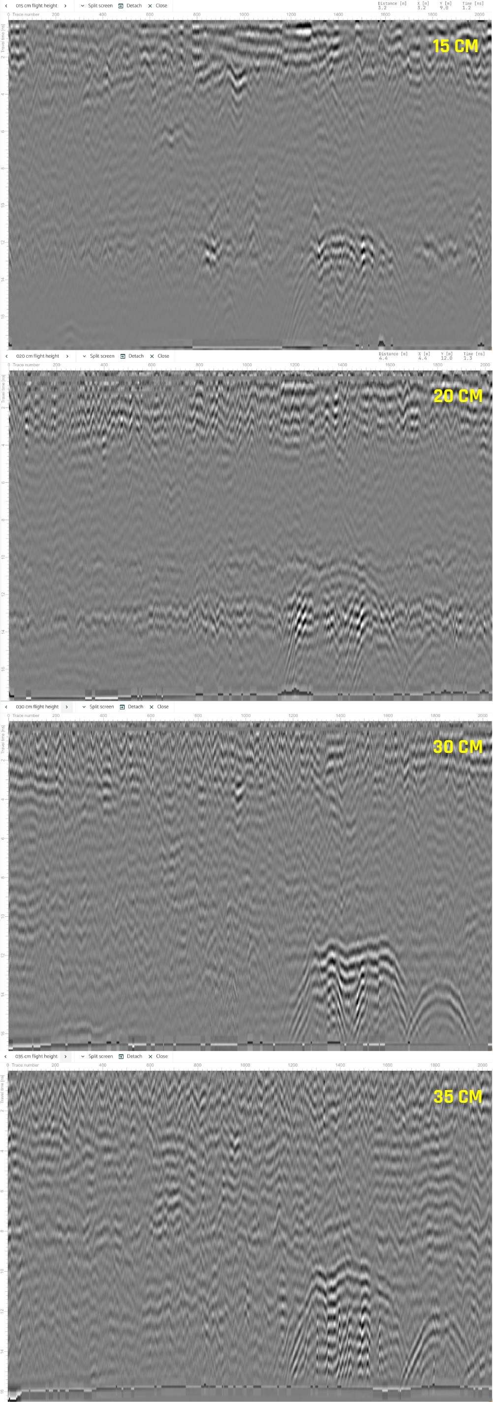
The profiles showcase the diminishing performance of drone GPR as it hovers at different heights above the ground. It becomes evident that as the drone gains altitude, the efficacy of detecting buried utilities diminishes significantly. In the world of buried utility mapping, precision and accuracy are paramount, and the sacrifices made for the sake of rapid aerial surveys can lead to critical errors and misinterpretations of data.
So what can we use drones for?
-
Aerial Inspections: Drones equipped with high-resolution cameras can capture aerial imagery of utility infrastructure. This allows for a quick and comprehensive overview of the entire area, identifying potential issues, damages, or unauthorized encroachments. Matt from MP Locates made a great point the other day that he takes photos with his drone which are then usable as a reference and for damage investigations, “Not only can you see your paint lines, but you can use that as the perfect reference for where your locate was. So if your marks were knocked out.. well here’s the photo of where i painted exactly! “
-
Thermal Imaging: Thermal cameras mounted on drones can detect temperature variations, making them useful for identifying hotspots or leaks in underground utility lines, electrical components, or pipelines. This is particularly valuable for preventative maintenance.
-
LiDAR Scanning: Light Detection and Ranging (LiDAR) technology on drones can create highly detailed 3D models of the terrain and utility infrastructure. These models can assist in planning, designing, and assessing the condition of utility assets.
-
Security Surveillance: Drones can be used for security patrols, ensuring the safety and integrity of utility sites by monitoring for unauthorized access or suspicious activity.
-
Mapping and Surveying: Drones can create high-resolution aerial maps and survey large areas efficiently, providing detailed topographical data for planning utility projects and infrastructure expansion. This may seem contradictory to the main topic of this conversation but it’s all about quality levels. If we assign Drone GPR at a lower quality level I think we solve the problem of how and when to use it. Solutions like Exodigo are even using AI to compliment the technology - but we need to be mindful of the limitations
Drone GPR may have its niche applications, but the limitations revealed in the University of Leeds study underscore the importance of understanding its constraints. As we explore the future of utility mapping technologies, a balanced consideration of the pros and cons of drone GPR is crucial. It's not the silver bullet it may initially appear to be, and its suitability for specific tasks must be carefully evaluated. Ultimately, the quest for effective buried utility mapping requires us to leverage technology wisely and thoughtfully, always with an eye on the nuances of physics and practical limitations.

RECENT POSTS


LATEST FROM NO DAMAGE
Share this Post