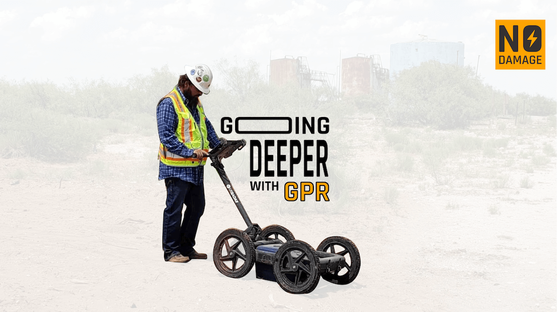
I’m always looking to learn more and educate myself - every day truly is a school day for me, which probably means I should have paid more attention in school. Recently, as more customers have been mentioning GPR and sharing the unique ways they’ve been using it, I decided it was time to dive deeper. It’s funny how we often hear terms we think we’re familiar with, but when pressed to explain them, we might fall short. For me, GPR was one of those terms. I realized I had a surface-level understanding but couldn’t fully articulate its capabilities or applications.
That needed to change. So, I started researching and came across a fascinating study by Tahar Bachiri and colleagues that dives into GPR’s application in civil engineering. The more I read, the more I saw how this technology fits perfectly into damage prevention and utility locating - two areas I’m deeply passionate about.
Here’s a summary of what I learned and why GPR is so important for our industry. It's not new technology, but maybe there's some new information here for you to learn too.
Ground Penetrating Radar (GPR) in Civil Engineering
Based on: GPR Application in Civil Engineering to Search and Detect Underground Networks
GPR is an essential tool in a number of industries including civil engineering and utility locating, enabling us to detect and characterize subsurface features with precision. Its success lies in balancing detection depth and spatial resolution - both of which are influenced by the frequency of the transmitter antenna.
For utility locators, this means having a tool that doesn’t just see underground but understands it. With utilities becoming increasingly complex, GPR offers a non-invasive way to locate pipelines, cables, and even old foundations that could otherwise remain hidden hazards. If you read Shane's article on The SUE Charade you'd know that, "it’s a nuanced tool that detects only 10-20% of utilities... GPR's effectiveness can vary dramatically based on soil conditions, utility depth, and other factors." That's a good mindset to approach GPR with: it's not perfect but it's another tool in your toolkit and if you wield it correctly, pretty useful.
How GPR Works: Resolution, Sampling, and Propagation
GPR uses electromagnetic waves to send signals underground and measures their reflections off different materials. By adjusting its parameters, we can achieve high levels of precision:
- Vertical Resolution: Determines the clarity of objects at different depths, depending on the antenna frequency and wave speed.
- Horizontal Resolution: Measures the smallest detectable distance between objects on the same horizontal plane, ensuring we don’t miss parallel utilities.
These calculations are critical, particularly in crowded areas where horizontal and vertical accuracy can mean the difference between safely avoiding utilities or causing costly damage.
Sampling and propagation play key roles, with GPR's effectiveness depending on signal frequency, dielectric properties of the subsurface, and scanning density. For example:
- Propagation Distance (L): L=c×tϵL = \frac{c \times t}{\sqrt{\epsilon}}L=ϵc×t, where ccc is the speed of light, ttt is transmission time, and ϵ\epsilonϵ is the dielectric constant.
- Trace Intervals (ΔxΔxΔx): Indicates the precision of scanning by accounting for frequency and environmental conditions.
Real-World Application: Findings from the Study
The study by Tahar Bachiri et al. explored GPR’s use in a controlled environment to detect underground utilities. Key findings included:
- Reinforced Concrete Detection: GPR identified partial reinforcements in concrete, with steel rebar reflecting signals and creating shadow zones. This highlights its ability to navigate through complex materials, even in modern construction.
- Subsurface Heterogeneity: Anomalies such as remnants of old infrastructure were detected, showcasing GPR's ability to spot issues before they become excavation challenges.
- Pipeline Detection: GPR detected multiple pipelines at varying depths. The hyperbolic reflections created by pipes were unmistakable, proving its utility in mapping complex underground networks.
These examples align perfectly with damage prevention goals: minimizing surprises during digging and maximizing safety and efficiency.
Why This Matters for Damage Prevention
As someone deeply invested in protecting critical infrastructure, I see tools like GPR as more than just technology - they’re enablers. They empower locators to do their job more effectively, reducing risks for contractors, municipalities, and the public.
At Utilocate, we integrate innovative solutions like GPR into broader workflows for utility locating and damage prevention. Combining tools like GPR with advanced ticket management systems creates a powerful synergy: we’re not just locating utilities; we’re creating data-driven processes that enhance safety, compliance, and transparency. That's how the industry is evolving and data capture and management is really the next frontier.
Final Thoughts: Looking Ahead
This dive into GPR reminded me of the importance of curiosity and lifelong learning. Tools like GPR are redefining how we approach excavation and damage prevention, giving us the ability to see deeper, plan better, and build smarter.
For those in the utility locating industry, it’s clear that GPR isn’t just a nice-to-have - it’s a must-have. As we continue to integrate technology like this into systems like Utilocate, the possibilities for improving safety and efficiency are endless.
Have you used GPR in your projects? I’d love to hear about your experiences - let’s keep the conversation going.
This article was inspired by Tahar Bachiri et al., International Journal of Emerging Trends in Engineering Research, 2020. You can read the full study here.
Share this Post
